
Tech giant Google has denied claims that it changed how borders between Morocco and Western Sahara appear on its mapping platform, following recent reports suggesting otherwise.
The clarification came after several media outlets alleged that Google Maps had modified the display of Western Sahara’s disputed boundary shortly after the UN Security Council endorsed Morocco’s 2007 autonomy proposal for the region.
In a statement released to AFP on Tuesday, November 11, a Google spokesperson refuted the claims, explaining that the differences users see depend on their geographic location rather than any recent updates.
“We have not made changes to Morocco or Western Sahara on Google Maps,” the spokesperson said.
“These labels follow our longstanding policies for disputed regions. People using Maps outside of Morocco see Western Sahara and a dotted line to represent its disputed border; people using Maps in Morocco do not see Western Sahara.”
According to the company, the dotted lines marking disputed territories have never been visible to users accessing Google Maps from within Morocco, contrary to viral reports.
The spokesperson emphasized that Google’s cartographic policies are consistent across all conflict regions worldwide, including those involving Israel–Palestine, India–Pakistan, and Russia–Ukraine.
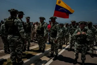
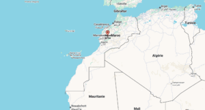
Western Sahara, a vast desert region rich in phosphate and fisheries, remains one of the world’s longest-running territorial disputes.
Formerly colonized by Spain, the territory has been under Morocco’s control since 1975, while the Polisario Front, backed by Algeria, continues to seek full independence.
The United Nations Security Council has for decades called for renewed negotiations among Morocco, the Polisario Front, Algeria, and Mauritania to achieve a lasting political solution.
However, tensions reignited after U.S. President Donald Trump’s administration recognized Morocco’s sovereignty over Western Sahara in exchange for Rabat’s normalization of diplomatic ties with Israel in 2020.
The UN Security Council’s recent endorsement of Morocco’s autonomy plan.
The confusion over Google Maps’ depiction of Western Sahara sparked debate across social media, with activists accusing the platform of “taking sides.”
However, Google insists that its mapping displays are strictly neutral and policy-based, not political.
“These representations reflect a standard approach,” the company reiterated, “which seeks to balance differing international perspectives on disputed regions.”
However, the Western Sahara conflict remains unresolved despite multiple peace efforts.
The Polisario Front, which operates from Tindouf, Algeria, has rejected Morocco’s autonomy proposal, calling instead for a referendum on independence, a move Rabat opposes.
Meanwhile, Morocco maintains that Western Sahara is an integral part of its territory, citing historical claims and development investments in the region.